

North Dakota at ‘crossroads’ as major flood fears rise

Advertisement
Read this article for free:
or
Already have an account? Log in here »
To continue reading, please subscribe:
Monthly Digital Subscription
$0 for the first 4 weeks*
- Enjoy unlimited reading on winnipegfreepress.com
- Read the E-Edition, our digital replica newspaper
- Access News Break, our award-winning app
- Play interactive puzzles
*No charge for 4 weeks then price increases to the regular rate of $19.00 plus GST every four weeks. Offer available to new and qualified returning subscribers only. Cancel any time.
Monthly Digital Subscription
$4.75/week*
- Enjoy unlimited reading on winnipegfreepress.com
- Read the E-Edition, our digital replica newspaper
- Access News Break, our award-winning app
- Play interactive puzzles
*Billed as $19 plus GST every four weeks. Cancel any time.
To continue reading, please subscribe:
Add Free Press access to your Brandon Sun subscription for only an additional
$1 for the first 4 weeks*
*Your next subscription payment will increase by $1.00 and you will be charged $16.99 plus GST for four weeks. After four weeks, your payment will increase to $23.99 plus GST every four weeks.
Read unlimited articles for free today:
or
Already have an account? Log in here »
Hey there, time traveller!
This article was published 06/04/2023 (978 days ago), so information in it may no longer be current.
The Colorado low weather system that recently dumped snow on both sides of the international border, accompanied by snow that hasn’t melted yet in North Dakota, has U.S. forecasters bumping up the risk of a major flood.
American officials are starting to see similarities with the run-up to the 1979 flood — an event that represented, according to Manitoba Infrastructure’s website, the “first major test of the Red River Floodway.”
Jim Kaiser, a warning co-ordination specialist with the National Weather Service, said the 24 centimetres of snow in Grand Forks, N.D., another 14 cm in Fargo, N.D., and amounts in communities and fields across eastern North Dakota and western Minnesota, has increased the chances of a flood on the U.S. side.
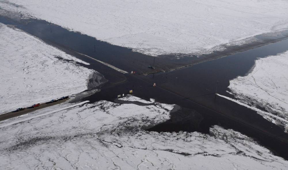
Jim Kaiser, a warning co-ordination specialist with the National Weather Service, said 14 cm of snow in Fargo, N.D., and amounts in communities and fields across eastern North Dakota and western Minnesota, has increased the chances of a flood on the U.S. side. (Carolyn Kaster / Associated Press files)
And it could have been worse.
“What we were happy with is the amount of water coming in (the storm) was less than forecast,” he said Thursday from Grand Forks.
“We missed the bull’s-eye… (It) was more west and that goes into the tributaries differently — so that is the good news,” Kaiser said.
“The bad news is we still had all of our winter snow on the ground… The last time it happened in April was 1979, that was the big flood before 1997.
“We’re sitting there at a crossroads. It is just how quickly it melts.”
A provincial spokesman said officials at Manitoba’s hydrologic forecast centre are reviewing the data from the latest dump of snow and had no new updates as of Thursday.
After winter storms blew through Minnesota and North Dakota in early March, the province bumped up its flood risk forecast to major (from moderate). It said the Red River was expected to spill its banks in several places between the international border and Winnipeg.
At that time, forecasters said no communities surrounded by ring dikes would be threatened.
In Manitoba history, the 1979 flood ranks in eighth place, behind the largest flood in 1826, as well as recent 1997 and 2009 events.
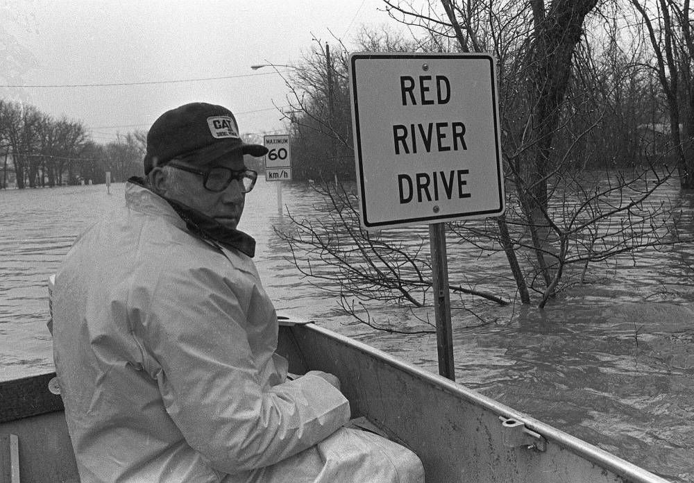
In Manitoba’s history, the 1979 flood ranks in eighth place. (Bill Brennan / UPC files)
Since the 1979 flood, the first major test of the Floodway, not only has that project seen its capacity massively increased, but communities all along the river have bolstered permanent ring dikes and individual rural structures now are either plopped on high mounds above any expected flood waters or have their own ring dikes.

American flood forecasters say the risk of flooding this year is already above long-term historical averages along the Red River, and it also brings a significant risk of overland flooding.
Kaiser said both North Dakota and Minnesota have bolstered flood protection through the years, so they should be okay with their permanent dike systems. If they do need sandbags, a city such as Fargo will only need hundreds of thousands of sandbags, instead of two to five million, he said.
However, the increased flood risk means a community such as Pembina, N.D., has gone from a 50 per cent chance of a major event to a 75 to 90 per cent chance, Kaiser said.
“We feel pretty comfortable handling the snowmelt, but… will we see rain?… We’ll see what happens.”
kevin.rollason@freepress.mb.ca
Kevin Rollason is a general assignment reporter at the Free Press. He graduated from Western University with a Masters of Journalism in 1985 and worked at the Winnipeg Sun until 1988, when he joined the Free Press. He has served as the Free Press’s city hall and law courts reporter and has won several awards, including a National Newspaper Award. Read more about Kevin.
Every piece of reporting Kevin produces is reviewed by an editing team before it is posted online or published in print — part of the Free Press‘s tradition, since 1872, of producing reliable independent journalism. Read more about Free Press’s history and mandate, and learn how our newsroom operates.
Our newsroom depends on a growing audience of readers to power our journalism. If you are not a paid reader, please consider becoming a subscriber.
Our newsroom depends on its audience of readers to power our journalism. Thank you for your support.
Related Articles
Mild weather, quickly melting snow trigger North Dakota flood fears
Advertisement Advertise With Us
Advertisement Advertise With Us
History
Updated on Thursday, April 6, 2023 9:40 PM CDT: Clarifies 1979 test of Floodway