

Looming Ontario storm raises risks of flood and widespread power outages
Advertisement
Read this article for free:
or
Already have an account? Log in here »
To continue reading, please subscribe:
Monthly Digital Subscription
$1 per week for 24 weeks*
- Enjoy unlimited reading on winnipegfreepress.com
- Read the E-Edition, our digital replica newspaper
- Access News Break, our award-winning app
- Play interactive puzzles
*Billed as $4.00 plus GST every four weeks. After 24 weeks, price increases to the regular rate of $19.95 plus GST every four weeks. Offer available to new and qualified returning subscribers only. Cancel any time.
Monthly Digital Subscription
$4.99/week*
- Enjoy unlimited reading on winnipegfreepress.com
- Read the E-Edition, our digital replica newspaper
- Access News Break, our award-winning app
- Play interactive puzzles
*Billed as $19.95 plus GST every four weeks. Cancel any time.
To continue reading, please subscribe:
Add Free Press access to your Brandon Sun subscription for only an additional
$1 for the first 4 weeks*
*Your next subscription payment will increase by $1.00 and you will be charged $16.99 plus GST for four weeks. After four weeks, your payment will increase to $23.99 plus GST every four weeks.
Read unlimited articles for free today:
or
Already have an account? Log in here »
TORONTO – The risk of flooding and widespread power outages loomed over Ontario on Tuesday with major rainfall and freezing rain set to batter a wide swath of the province.
Much of the province was under yellow and orange weather warnings with the storm expected to hit Tuesday night through Wednesday.
Eastern Ontario could be among the hardest-hit regions with some areas expected to endure 24 hours of potent freezing rain, Environment Canada said. Widespread utility outages were possible as up to 20 millimetres of ice buildup was expected to test the resilience of trees and power lines.
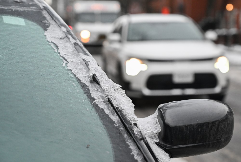
The forecast looked similar to the major 2023 ice storm that knocked out power to tens of thousands in eastern Ontario, said warning preparedness meteorologist Eric Tomlinson.
“This seems to be quite a similar event in terms of potential impacts,” said Tomlinson.
Other parts of the province will not be spared.
Environment Canada said much of southern Ontario could see between 20 and 40 millimetres of rain, and possibly more in some areas. Flood warnings have been issued by several conservation authorities as waterways already swollen by snow melt from recent balmy temperatures hit their limits.
Cambridge, Brantford, Six Nations and several other communities along the Grand River were under the flood warnings Tuesday.
“While the risk of ice jams is believed to be past, river flows remain extremely high,” the Grand River conservation authority said in a statement.
The municipalities of North Perth and Huron East were also under a flood warning. The Maitland Valley conservation authority says flows there are expected to stay elevated well into the week, “making this a potentially long-duration event.”

“Rural roads in the area may become flooded and hazardous,” the conservation authority said.
Into cottage country, rain is expected to mix with freezing rain for several hours.
Old man winter has not relented his grip either. Snow is added to the messy mix of precipitation around Sudbury. A winter storm warning is in place from around Sault Ste. Marie through to Timmins where Environment Canada is calling for between 10 and 20 centimetres of snowfall.
Colder temperatures were expected to move in behind the storm and potentially keep frozen surfaces slippery and hard to navigate for the coming days, said Tomlinson, the meteorologist
This report by The Canadian Press was first published March 10, 2026.
Related Articles
A first, important step for a national grid
Advertisement Advertise With Us
Advertisement Advertise With Us