

Ernesto to swing south of Newfoundland, but it will bring heavy rain and high seas
Advertisement
Read this article for free:
or
Already have an account? Log in here »
To continue reading, please subscribe:

Digital Subscription
One year of digital access for only $205*
- Enjoy unlimited reading on winnipegfreepress.com
- Read the E-Edition, our digital replica newspaper
- Access News Break, our award-winning app
- Play interactive puzzles
*First annual payment billed as $205.00 + GST for one year. This annual subscription will automatically renew at $233.00 + GST every 52 weeks (10% off the regular annual price of $259.35). Offer available to new and qualified returning subscribers only. Cancel any time.
To continue reading, please subscribe:
Add Free Press access to your Brandon Sun subscription for only an additional
$1 for the first 4 weeks*
- Enjoy unlimited reading on winnipegfreepress.com
- Read the E-Edition, our digital replica newspaper
- Access News Break, our award-winning app
- Play interactive puzzles
*Your next Brandon Sun subscription payment will increase by $1.00 and you will be charged $17.95 plus GST for four weeks. After four weeks, your payment will increase to $24.95 plus GST every four weeks.
Read unlimited articles for free today:
or
Already have an account? Log in here »
Hey there, time traveller!
This article was published 19/08/2024 (762 days ago), so information in it may no longer be current.
ST. JOHN’S, N.L. – Newfoundland appeared to catch a lucky break Monday with Hurricane Ernesto expected to pass south of the island, but the fast-moving storm was still forecast to bring intense rain over a short period.
Environment Canada issued a tropical cyclone information statement for the eastern part of the province, including the capital of St. John’s, N.L., saying the storm would transition to a post-tropical storm as it passed the region late Monday. Ernesto could bring 25 millimetres of rain per hour over a three-hour window, the agency said, with up to 80 millimetres total expected in some areas — particularly in southeastern Newfoundland.
Up to 60 millimetres were expected to fall in the vicinity of St. John’s.
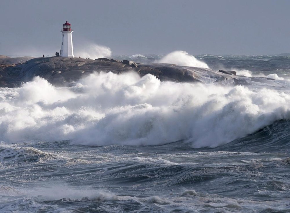
David Neil, a warning preparedness meteorologist for Environment Canada, said the island would avoid Ernesto’s worst impacts, but he advised people to stay off the roads and away from the coast on Monday night as the storm was also expected to bring powerful waves.
“It’s going to go through within the course of a few hours, but it will be quite wet and quite nasty there for a few hours,” Neil said in an interview Monday. “Definitely dodging a bit of a bullet here, but it’s still not going to be a nice night.”
Ernesto made landfall in Bermuda on Saturday, knocking out power for more than 23,000 people in the tiny British territory. It weakened into a tropical storm as it moved away from the archipelago, but regained strength on Sunday and was once again classified as a hurricane.
By early Monday, the storm was about 110 kilometres south-southwest of Newfoundland’s Cape Race, according to an update from Environment Canada. It was moving at about 56 kilometres an hour with maximum winds measuring 130 km/h.
There had been fears that the storm would hurtle through the North Atlantic straight for Newfoundland and Labrador, but by Monday morning Neil said it was veering well south of Canada’s easternmost province.
A rainfall warning was in effect for eastern parts of the Avalon Peninsula, including St. John’s, on Monday. Neil said some of Monday’s rain was not caused by Ernesto, but by an unrelated tropical air mass.
Winds gusting between 60 and 80 km/h were expected to drive large waves along southeastern Newfoundland, and Environment Canada warned of possible coastal flooding, particularly along the southern coast stretching from the Burin to the Avalon peninsulas.
“There could be some minor damage to docks and coastal structures,” the weather agency said.
Neil cautioned curious wave watchers to stay away.
“I know people like to go see the big waves with these storms. It is quite dangerous,” he said. “Those waves can come up quite quickly and certainly, there’s a risk there that you could get caught unawares.”
The rain and high seas were expected to be over for Newfoundland by early Tuesday. The storm also brought large swells to Nova Scotia’s Atlantic coast on Monday, which were expected to abate later in the evening, Environment Canada said.
This report by The Canadian Press was first published Aug. 19, 2024.