

A history of kicking the can
Advertisement
Read this article for free:
or
Already have an account? Log in here »
To continue reading, please subscribe:

Digital Subscription
One year of digital access for only $205*
- Enjoy unlimited reading on winnipegfreepress.com
- Read the E-Edition, our digital replica newspaper
- Access News Break, our award-winning app
- Play interactive puzzles
*First annual payment billed as $205.00 + GST for one year. This annual subscription will automatically renew at $233.00 + GST every 52 weeks (10% off the regular annual price of $259.35). Offer available to new and qualified returning subscribers only. Cancel any time.
To continue reading, please subscribe:
Add Free Press access to your Brandon Sun subscription for only an additional
$1 for the first 4 weeks*
- Enjoy unlimited reading on winnipegfreepress.com
- Read the E-Edition, our digital replica newspaper
- Access News Break, our award-winning app
- Play interactive puzzles
*Your next Brandon Sun subscription payment will increase by $1.00 and you will be charged $17.95 plus GST for four weeks. After four weeks, your payment will increase to $24.95 plus GST every four weeks.
Read unlimited articles for free today:
or
Already have an account? Log in here »
Hey there, time traveller!
This article was published 01/12/2023 (962 days ago), so information in it may no longer be current.
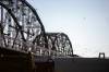
The very first time I drove over the Arlington Bridge I was in a panic. Relatively new to Winnipeg, I was lost, late and trying to find a restaurant for a lunch date with a friend. I suddenly found myself on this weird bridge that towered over an expanse of railway tracks and sent into the clearly demarcated North End of Winnipeg.
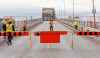
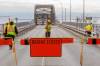
News last week that the bridge is now closed permanently was not a surprise for anyone who has followed the history of the bridge in Winnipeg. According to Christian Cassidy who has chronicled its history, it would appear that the Arlington Bridge was always on the verge of being closed.
Infrastructure such as bridges, roads, highways and sidewalks have important implications in terms of community development. There’s been considerable research on how cities create areas of economic privilege and pockets of poverty through infrastructure spending.
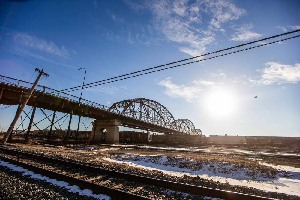
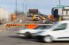
MIKAELA MACKENZIE / WINNIPEG FREE PRESS
The Arlington Street Bridge, as seen from Jarvis Avenue, on Wednesday. The bridge has long been a ‘bugbear’ — impractical for streetcars and unable to handle heavy truck and bus traffic after the 1960s.
The Arlington Bridge is one example.
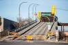
The bridge opened in 1912 in Winnipeg. It was viewed as a “bugbear” from the beginning, as Cassidy chronicles, too impractical for streetcars and after the 1960s incapable of handling heavy truck traffic and buses. North End residents were limited in their ability to move from one area of the city to the other because of the enormity of the rail yards and the lack of bridges.
In a 2020 study published in the Journal of Construction Engineering and Management there is a clear relationship between bridge construction and economically disadvantaged groups. The research quotes Langdon Winner who states that traffic restrictions on bridges “may disproportionately affect those groups who rely more on public transportation and may thus segregate across different socioeconomic and demographic groups.”
The Arlington Bridge is not a bridge over water, but a bridge over a rail yard. Started in 1881, the CPR’s yards now split the north and south of the city with more than 300 hectares of industrial works. Discussions about moving the rail yards have perennially cropped up and then been cut down by various governments with the costs being cited as the main concern.
However, the Lac-Mégantic rail disaster that killed 47 people in 2013 has underscored how dangerous rail traffic through populated areas can be. A spring 2023 derailment at McPhillips Street between Logan and Jarvis that shut down the Friday-morning rush hour made many Winnipeggers nervous. After the spring derailment, then-premier Heather Stefanson seemed to be interested in reopening discussions. Mayor Scott Gillingham has suggested there may be a willingness to investigate the idea but acknowledged it could take some time before it could become a reality.
More “kicking of the can” on an issue that is not going to go away any time soon.
In 2015, I was privileged to be part of a Canadian group invited to visit the United States on an exchange visit courtesy of the state department. While in New Orleans, I organized a tour of the Lower Ninth Ward to see the damage left over after Hurricane Katrina a decade before. To enter the Lower Ninth, my tour took me over the St. Claude Avenue Bridge, which reminded me of the Arlington Street Bridge.

Built in 1919, the bridge carried me from a wealthy, tourist side of New Orleans into a predominantly Black, impoverished part of that city, over the Industrial Canal and into an area that was still coping with the devastation of a category five hurricane. The Lower Ninth ward was the last part of New Orleans to have the curfew lifted, a year after the hurricane hit and the last part of the city to be officially reopened with full utility services. When I was there in 2015, there were still empty lots and boarded up buildings as people fought with insurance companies over claims.
The cause for the levee breaks in the Lower Ninth was determined to be erosion brought about by the loss of protective coastal wetlands that had once acted as a storm surge buffer for the community. Another example of how infrastructure failed to support those who were less economically advantaged.
Hurricane Katrina also serves as a wakeup call for the effect of climate change in impoverished neighbourhoods. As the climate becomes warmer, those living in older homes and denser neighborhoods will need access to cooling sheds and recreational facilities for relief. With a decline in air quality, homes that don’t have air conditioning means that open windows as the only way to cool temperatures will also affect health. Dense populations and a lack of green space means cities core temperatures remain artificially high, providing little respite from the heat.
Yet it seems that the inequality created by the ongoing demarcation of poverty in cities like Winnipeg comes down to dollars and cents. And we kick the can further down the road.
Shannon Sampert is a communications consultant, freelance editor for Policy Options and former politics and perspectives editor at the Free Press. She teaches part time at the University of Manitoba. shannon@mediadiva.ca
Related Articles
Bridge closure an opportunity
Advertisement Advertise With Us
Advertisement Advertise With Us