

Record heat recorded in Dallas as scorching summer continues in the United States
Advertisement
Read this article for free:
or
Already have an account? Log in here »
To continue reading, please subscribe:

Digital Subscription
One year of digital access for only $205*
- Enjoy unlimited reading on winnipegfreepress.com
- Read the E-Edition, our digital replica newspaper
- Access News Break, our award-winning app
- Play interactive puzzles
*First annual payment billed as $205.00 + GST for one year. This annual subscription will automatically renew at $233.00 + GST every 52 weeks (10% off the regular annual price of $259.35). Offer available to new and qualified returning subscribers only. Cancel any time.
To continue reading, please subscribe:
Add Free Press access to your Brandon Sun subscription for only an additional
$1 for the first 4 weeks*
- Enjoy unlimited reading on winnipegfreepress.com
- Read the E-Edition, our digital replica newspaper
- Access News Break, our award-winning app
- Play interactive puzzles
*Your next Brandon Sun subscription payment will increase by $1.00 and you will be charged $17.95 plus GST for four weeks. After four weeks, your payment will increase to $24.95 plus GST every four weeks.
Read unlimited articles for free today:
or
Already have an account? Log in here »
Hey there, time traveller!
This article was published 26/08/2023 (1133 days ago), so information in it may no longer be current.
Another record-setting day of high temperatures hit the Dallas/Fort Worth area Saturday before a slight cooling trend moves into the area, according to the National Weather Service, as heat warnings stretch from the Gulf Coast to the Southeastern U.S. and upper Mid-South.
Temperatures in the area reached 110 degrees Fahrenheit (43.3 degrees Celsius), breaking by four degrees the previous record for this date that was set in 2011, according to the National Weather Service.
The heat dome that has been over the state since June is expected to move out of the area soon, according to weather service meteorologist Ted Ryan.
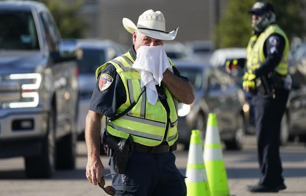
Excessive heat warnings were in effect for much of eastern Texas, most of both Louisiana and Mississippi and portions of Arkansas, Tennessee, Missouri, Kentucky, Illinois and the Florida Panhandle.
The Electric Reliability Council of Texas, or ERCOT, has asked the state’s 30 million residents five times this summer to voluntarily reduce power usage because of the high temperatures creating high demand for electricity.
ERCOT has reached record high-peak demand for power 10 times since June, according to its website.
The historic heat wave stretched over portions of Mississippi and Louisiana as well.
Peak heat-index readings of 119 degrees F and 120 degrees F (48.3 C and 48.9 C) are expected across the entire area.
In Mississippi, the city of Jackson remained under an excessive heat warning as temperatures were expected to peak Saturday at 103 degrees F (39.4 C). City officials said the high temperatures are putting a strain on the city’s water system as an additional four million gallons of water are being delivered through the system each day. JXN Water is asking residents to cut their water usage to help conserve it.
Meanwhile, in Louisiana the entire state was under an excessive heat warning and a burn ban due to critical fire weather conditions persisting.
“This is the hottest summer we’ve ever recorded,” National Weather Service Meteorologist Phil Grigsby said in Louisiana.
As of Friday, the area has had a heat index reading — what the temperature feels like — over 105 degrees F (40.6) for 55 days, since June 1, Grigsby said.
For the Dallas area, which has had nine record high temperature days before Saturday, slightly cooler temperatures are expected.
“There’s going to be a front that starts making its way down here, the high is only going to be 103 degrees (Sunday),” Ryan said with a laugh. “But Monday and Tuesday highs are going to be in the mid 90s, which is right around normal … 95 is going to feel pretty good for a lot of us.”
Ryan said highs above 100 are likely not at an end with temperatures probably reaching above that level during September.
Grigsby said temporary relief is also on the horizon in neighboring Louisiana.
“We will see a cold front come down across the area” as the tropical low pressure heads toward Florida, Grigsby said. “That will push the 100 to 105 degree temperatures to the more typical temperatures we’re used to seeing in August, into the lower 90s.”