Chantal, now a tropical depression, raises concerns of flash flooding in North Carolina and Virginia
Advertisement
Read this article for free:
or
Already have an account? Log in here »
To continue reading, please subscribe:
Monthly Digital Subscription
$1 per week for 24 weeks*
- Enjoy unlimited reading on winnipegfreepress.com
- Read the E-Edition, our digital replica newspaper
- Access News Break, our award-winning app
- Play interactive puzzles
*Billed as $4.00 plus GST every four weeks. After 24 weeks, price increases to the regular rate of $19.95 plus GST every four weeks. Offer available to new and qualified returning subscribers only. Cancel any time.
Monthly Digital Subscription
$4.99/week*
- Enjoy unlimited reading on winnipegfreepress.com
- Read the E-Edition, our digital replica newspaper
- Access News Break, our award-winning app
- Play interactive puzzles
*Billed as $19.95 plus GST every four weeks. Cancel any time.
To continue reading, please subscribe:
Add Free Press access to your Brandon Sun subscription for only an additional
$1 for the first 4 weeks*
*Your next subscription payment will increase by $1.00 and you will be charged $16.99 plus GST for four weeks. After four weeks, your payment will increase to $23.99 plus GST every four weeks.
Read unlimited articles for free today:
or
Already have an account? Log in here »
Hey there, time traveller!
This article was published 06/07/2025 (266 days ago), so information in it may no longer be current.
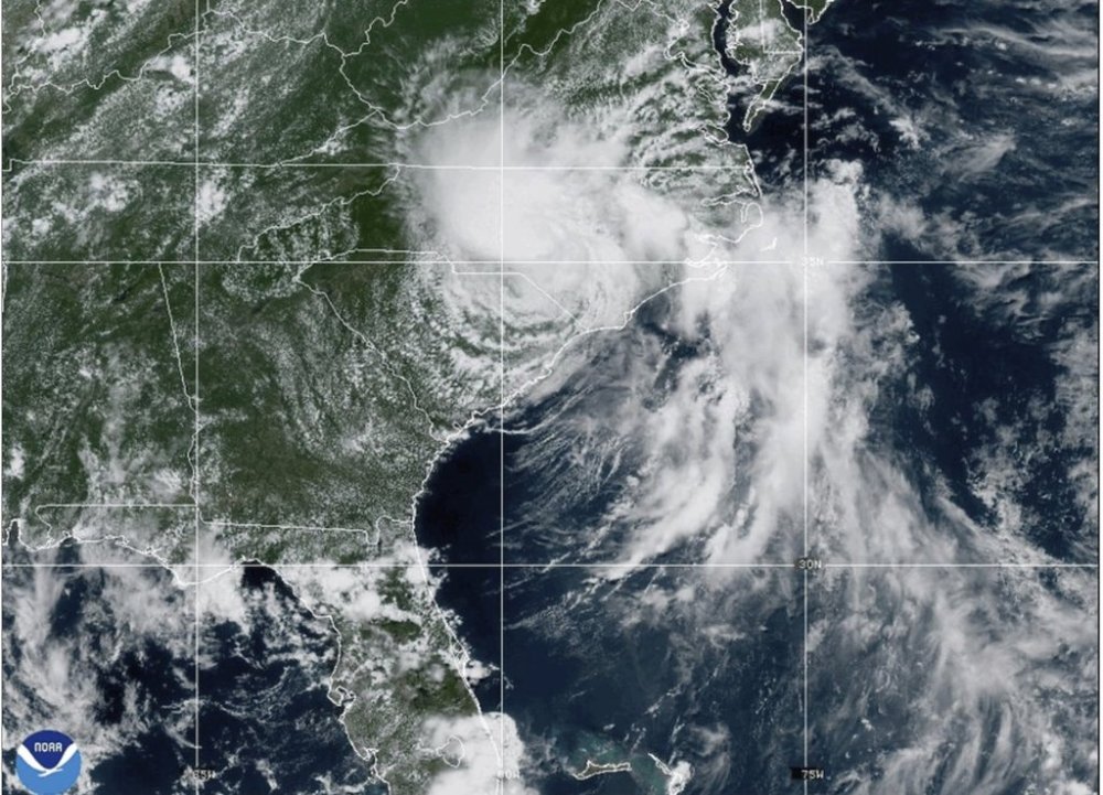
MIAMI (AP) — Tropical Storm Chantal was downgraded to a depression Sunday but raised concerns of possible flash flooding as it makes its way through central North Carolina toward south-central Virginia.
Chantal made landfall near Litchfield Beach, South Carolina, at about 4 a.m. EDT Sunday, the National Hurricane Center in Miami said. At 5 p.m., it was located about 65 miles (105 kilometers) south-southwest of Raleigh, North Carolina, and was moving north-northeast at 10 mph (17 kph) with maximum sustained winds of 30 mph (45 kph).
The system was expected to turn more to the northeast late Sunday as it weakens over North Carolina but may strengthen slightly as it approaches the Virginia Capes on Monday. Flood watches were issued for central North Carolina and south-central Virginia through Monday, with total rainfall of 2 to 4 inches (5 to 10 centimeters) and local amounts up to 6 inches (15 centimeters) that could lead to flash flooding, the hurricane center said.
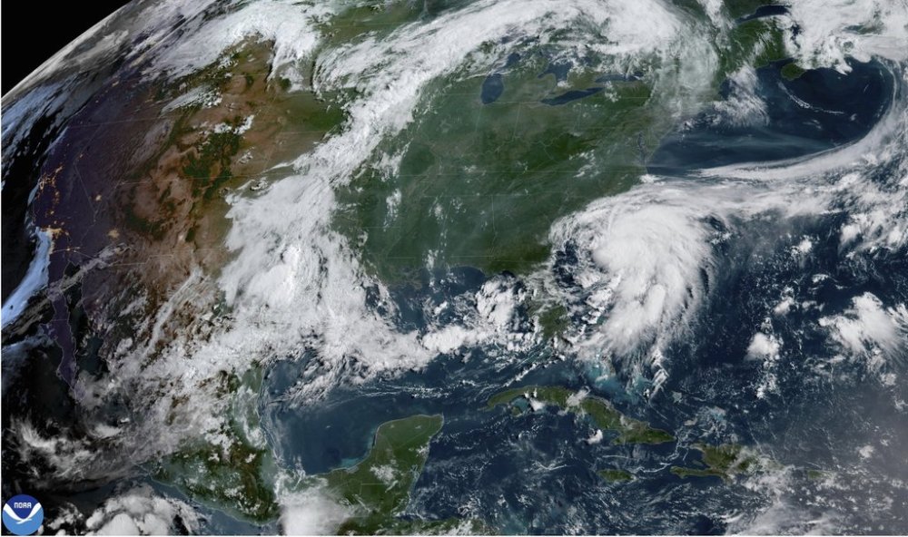
Forecasters said dangerous surf and rip currents at beaches from northeastern Florida to the mid-Atlantic states are expected to last for the next couple of days.