Hurricane Lee to weaken as it approaches Maritimes, but will still pack a punch

Advertisement

Advertise with us

HALIFAX - Hurricane Lee is expected to lash parts of the Maritimes with strong winds and heavy rain this weekend, but the Canadian Hurricane Centre says much of its strength will be sapped by cooler sea-surface temperatures as it moves north.

Read this article for free:


or

Already have an account? Log in here »

To continue reading, please subscribe:

Subscribe and receive a limited-edition Free Press branded hat or tote.

Digital Subscription

One year of digital access for only $205*

  • Enjoy unlimited reading on winnipegfreepress.com
  • Read the E-Edition, our digital replica newspaper
  • Access News Break, our award-winning app
  • Play interactive puzzles

*First annual payment billed as $205.00 + GST for one year. This annual subscription will automatically renew at $233.00 + GST every 52 weeks (10% off the regular annual price of $259.35). Offer available to new and qualified returning subscribers only. Cancel any time.

To continue reading, please subscribe:

Add Free Press access to your Brandon Sun subscription for only an additional

$1 for the first 4 weeks*

  • Enjoy unlimited reading on winnipegfreepress.com
  • Read the E-Edition, our digital replica newspaper
  • Access News Break, our award-winning app
  • Play interactive puzzles
Start now

*Your next Brandon Sun subscription payment will increase by $1.00 and you will be charged $17.95 plus GST for four weeks. After four weeks, your payment will increase to $24.95 plus GST every four weeks.

Hey there, time traveller!
This article was published 12/09/2023 (1111 days ago), so information in it may no longer be current.

HALIFAX – Hurricane Lee is expected to lash parts of the Maritimes with strong winds and heavy rain this weekend, but the Canadian Hurricane Centre says much of its strength will be sapped by cooler sea-surface temperatures as it moves north.

By early Tuesday afternoon, the Category 3 hurricane was about 900 kilometres south of Bermuda, churning out winds at 185 kilometres per hour. The slow-moving storm was forecast to make a turn to the north on Wednesday and then accelerate toward Canada.

The hurricane centre in Halifax issued a statement Tuesday saying the approaching storm is expected to slow the progress of the front of an air mass, increasing the risk of heavy rain over the Maritimes on Thursday and Friday.
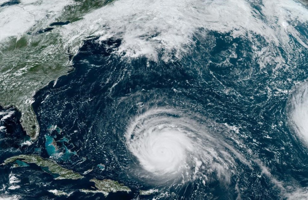
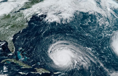
This satellite image provided by CIRA/NOAA shows hurricane Lee in the Atlantic Ocean on Monday, September 11, 2023. The Canadian Hurricane Centre says hurricane Lee could make landfall this weekend anywhere from Maine to southeastern Nova Scotia. THE CANADIAN PRESS/HO-CIRA/NOAA

“As of now, western Nova Scotia has the higher possibility of impacts, which is worth noting since that region wasn’t impacted by recent storms like Dorian (in 2019) and Fiona (in 2022),” the statement said, referring to powerful post-tropical storms that made landfall farther to the east in Nova Scotia.

Though Lee could enter Canadian waters as a hurricane, it is expected to transition to a post-tropical storm as is moves northward.

Environment Canada meteorologist Ian Hubbard said the storm is expected make landfall on Saturday or Sunday. He said it was too early to offer specific predictions about wind speeds.

“There will be quite a diminishing of wind before it comes anywhere close to land,” he said. “That’s a good thing.”

Hubbard said the storm is expected to be considerably weaker than Fiona, which roared across Atlantic Canada almost a year ago, causing widespread damage and killing two people. Still, Lee could dump between 50 to 100 millimetres of rain on some areas, he said, adding that the heaviest rain typically falls on the left side of the storm’s track.

The strength of Lee’s winds will drop as it crosses over parts of the Atlantic churned-up by hurricane Franklin and hurricane Idalia in recent weeks.

“They both left in their wake an area of cooler water that wasn’t there beforehand,” Hubbard said from the hurricane centre in Halifax. “That does reduce the fuel supply for these hurricanes, as they like to feed on that warm water.”

As a result, Lee is not expected to produce hurricane-strength winds, which are above 119 km/h, once it reaches the Atlantic region.

“This is going to be a much weaker storm (than Fiona) in terms of what its winds are,” Hubbard said.

But that doesn’t mean the region’s residents should relax. The storm will expand during its transition, and its heavy rain and gusts could still do damage.

“Don’t let your guard down just because it’s no longer a hurricane,” Hubbard cautioned. “All of the energy of the hurricane is still present, and as it goes post-tropical, those wind fields actually get larger than a compact hurricane. In some ways, more people could be affected.”

The centre’s statement confirmed that view: “Since it will be a rather broad system, the rain, wind (and) waves would affect most of the Maritime provinces …. Lee will be much weakened before reaching Newfoundland.”

Meanwhile, rough surf conditions and rip currents are expected along the Atlantic coast of Nova Scotia, particularly on Friday.

This report by The Canadian Press was first published Sept. 12, 2023.

Report Error Submit a Tip

More Stories

Bombers let another one slip away and face pivotal issue

Taylor Allen 7 minute read Preview

Bombers let another one slip away and face pivotal issue

Taylor Allen 7 minute read Yesterday at 6:07 PM CDT

Mike O’Shea summed it up best.

“That one doesn’t feel very good.”

Nor should it.

The Winnipeg Blue Bombers started out hot Friday night, only to run out of gas down the stretch and allow the visiting Toronto Argonauts to steal a 30-28 victory.

Read
Yesterday at 6:07 PM CDT

Flammable gas culprit of 2024 Transcona home explosion: police

Malak Abas 2 minute read Preview

Flammable gas culprit of 2024 Transcona home explosion: police

Malak Abas 2 minute read Friday, Sep. 25, 2026

Flammable gas is believed to be the cause of a 2024 house explosion in Transcona that damaged neighbouring homes and displaced residents.

“As a result of the investigation and upon Crown review, the explosion is believed to be an isolated incident,” Winnipeg Police Service Const. Dani McKinnon said in an email Friday afternoon.

“There are no public safety concerns connected to this incident, and no criminal charges have been laid.”

The sudden blast happened in a bungalow on Camrose Bay on June 26, 2024. It levelled the home and caused significant damage to 22 other houses. At the time, it was described as “catastrophic” by the fire chief at the scene.

Read
Friday, Sep. 25, 2026

Tenants slam Alta.-based landlord, protest rent increases

Scott Billeck 6 minute read Preview

Tenants slam Alta.-based landlord, protest rent increases

Scott Billeck 6 minute read Friday, Sep. 25, 2026

Charlie Medd wasn’t ready for another adventure last October, when she moved out of the Wolseley Avenue apartment she had called home for 15 years.

Medd said life at Lincoln Apartments began to change after Wingspan Properties, an Alberta-based landlord, bought the building, made minor cosmetic changes and increased rent. She felt the changes were intended to push renters — many of them on fixed incomes — out the door.

“At some point, I got scared. I’d been there 15 years,” Medd said about the threat of rent increases. “I’d just painted my whole apartment. But when I heard that there’s going to be that many people homeless, I thought, ‘I’m too old for another adventure.’

“It felt like you were getting a nudge out the door. Like, ‘Yeah, we’re going to be doing this, and your rent is going to go up every year.’”

Read
Friday, Sep. 25, 2026

Is a better Winnipeg on the horizon?

Tom Brodbeck, Rebecca Chambers, Niigaan Sinclair and Brent Bellamy 20 minute read Preview

Is a better Winnipeg on the horizon?

Tom Brodbeck, Rebecca Chambers, Niigaan Sinclair and Brent Bellamy 20 minute read Friday, Sep. 25, 2026

Four Free Press columnists weigh in on the challenges ahead and how the city can become better.

Read
Friday, Sep. 25, 2026

Gordon Bell students relish — ‘of all things’ — new pickleball courts

Maggie Macintosh 4 minute read Preview

Gordon Bell students relish — ‘of all things’ — new pickleball courts

Maggie Macintosh 4 minute read Yesterday at 6:00 AM CDT

Manitoba’s newest public school sports facility is bringing the pickleball craze to an inner-city campus.

Gordon Bell High School unveiled four custom-made courts for the popular paddle sport this fall as part of a multi-faceted makeover.

Grade 12 student Matea Thiessen Unger called the courts “the cherry on top,” of a multi-year construction project that consumed much of her high school career.

“It was happening for so long — it felt like it was never going to end,” the 16-year-old said.

Read
Yesterday at 6:00 AM CDT

Hurricane Lee set to weaken in days ahead

Michael MacDonald, The Canadian Press 4 minute read Preview

Hurricane Lee set to weaken in days ahead

Michael MacDonald, The Canadian Press 4 minute read Tuesday, Sep. 12, 2023

HALIFAX - Hurricane Lee is expected to lash parts of the Maritimes with strong winds and heavy rain this weekend, but the Canadian Hurricane Centre says much of its strength will be sapped by cooler sea-surface temperatures as it moves north.

By early Tuesday afternoon, the Category 3 hurricane was about 900 kilometres south of Bermuda, churning out winds at 185 kilometres per hour. The slow-moving storm was forecast to make a turn to the north on Wednesday and then accelerate toward Canada.

The hurricane centre in Halifax issued a statement Tuesday saying the approaching storm is expected to slow the progress of the front of an air mass, increasing the risk of heavy rain over the Maritimes on Thursday and Friday.

"As of now, western Nova Scotia has the higher possibility of impacts, which is worth noting since that region wasn't impacted by recent storms like Dorian (in 2019) and Fiona (in 2022)," the statement said, referring to powerful post-tropical storms that made landfall farther to the east in Nova Scotia.

Read
Tuesday, Sep. 12, 2023