

Red River’s expected crest downgraded: forecasters
Advertisement
Read this article for free:
or
Already have an account? Log in here »
To continue reading, please subscribe:
Digital Subscription
One year of digital access for only $1.44 a week*
- Enjoy unlimited reading on winnipegfreepress.com
- Read the E-Edition, our digital replica newspaper
- Access News Break, our award-winning app
- Play interactive puzzles
*Billed as $5.77 plus GST every four weeks. After 52 weeks, price increases to the regular rate of $19.95 plus GST every four weeks. Offer available to new and qualified returning subscribers only. Cancel any time.
To continue reading, please subscribe:
Add Free Press access to your Brandon Sun subscription for only an additional
$1 for the first 4 weeks*
- Enjoy unlimited reading on winnipegfreepress.com
- Read the E-Edition, our digital replica newspaper
- Access News Break, our award-winning app
- Play interactive puzzles
*Your next Brandon Sun subscription payment will increase by $1.00 and you will be charged $17.95 plus GST for four weeks. After four weeks, your payment will increase to $24.95 plus GST every four weeks.
Read unlimited articles for free today:
or
Already have an account? Log in here »
Hey there, time traveller!
This article was published 13/04/2011 (5523 days ago), so information in it may no longer be current.
WINNIPEG – The worst-case scenario for a Red River crest in Winnipeg has been reduced to the level of the 2009 spring flood, as provincial flood forecasters have modified their projections.
The Red River is now expected to crest in Winnipeg no higher than 22.8 feet above normal winter ice level in the coming weeks, which is 0.2 feet above the crest of the 2009 flood, the second-largest in recent history.
At the same time, the scale of overland and river flooding across the province is unprecedented, provincial officials said this afternoon.
"We’re still dealing with flooding on an unprecedented geographic scale," said Steve Ashton, the provincial infrastructure and transportation minister, referring to flooding along the Red, Assiniboine, Morris, Roseau, Souris, Fisher, Icelandic and Saskatchewan rivers, as well as in many rural municipalities.
"At times it may appear the severity of the flood is significantly less," Ashton said. "I want to stress this is a very serious flood."
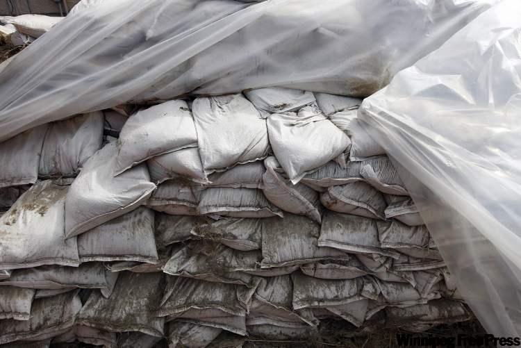
Approximately 55 highways are closed across the province, partial ring dikes are in place at six Red River Valley communities and about 300 people have been forced from their homes on three First Nations, he said.
brightcove.createExperiences();
"I want to stress many of these evacuations are precautionary," Ashton said.
As a result of the new provincial forecast, the City of Winnipeg has reduced the number of properties on its flood-protection list to 129 from 560.
Thirty-five of these properties have sandbag dikes in place that can handle a Red River level of 22.8 feet James.
Another 94 will need to build up their dikes. All but five are located on Kingston Crescent, Scotia Street and Glenwood Crescent.
Related Articles
Chief says Peguis needs protection from annual flooding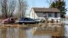


Advertisement Advertise With Us
History
Updated on Wednesday, April 13, 2011 3:41 PM CDT: Adds details