It’s one storm after another for much of the US, but the next one’s path is uncertain
Advertisement
Read this article for free:
or
Already have an account? Log in here »
To continue reading, please subscribe:

Digital Subscription
One year of digital access for only $205*
- Enjoy unlimited reading on winnipegfreepress.com
- Read the E-Edition, our digital replica newspaper
- Access News Break, our award-winning app
- Play interactive puzzles
*First annual payment billed as $205.00 + GST for one year. This annual subscription will automatically renew at $233.00 + GST every 52 weeks (10% off the regular annual price of $259.35). Offer available to new and qualified returning subscribers only. Cancel any time.
To continue reading, please subscribe:
Add Free Press access to your Brandon Sun subscription for only an additional
$1 for the first 4 weeks*
- Enjoy unlimited reading on winnipegfreepress.com
- Read the E-Edition, our digital replica newspaper
- Access News Break, our award-winning app
- Play interactive puzzles
*Your next Brandon Sun subscription payment will increase by $1.00 and you will be charged $17.95 plus GST for four weeks. After four weeks, your payment will increase to $24.95 plus GST every four weeks.
Read unlimited articles for free today:
or
Already have an account? Log in here »
Hey there, time traveller!
This article was published 28/01/2026 (245 days ago), so information in it may no longer be current.
HOUSTON (AP) — Winter’s brutal grip on the U.S. East is not letting up, with coming days bringing subfreezing temperatures that will plunge deep into what had been a toasty Florida peninsula and a powerful blizzard forecast that may strike the Atlantic coast.
Deep cold is forecast to stick around at least into the first week of February. Meteorologists are also watching what could become a “ bomb cyclone ” — a quickly intensifying storm that’s a winter version of a hurricane — forming off the Carolinas Friday night into Saturday.
“A major winter storm appears to be coming to the Carolinas,” said meteorologist Peter Mullinax of the National Oceanic and Atmospheric Administration’s Weather Prediction Center.
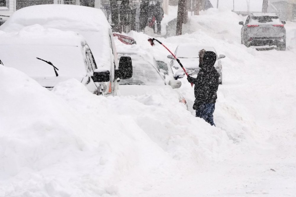
That storm could dump snow — at least 6 inches (15 centimeters) with white-out conditions — in the Carolinas, northern Georgia and southern Virginia. After that, it could turn and plow through the Interstate 95 corridor late Saturday into Sunday to dump loads more snow from Washington to Boston, further paralyzing much of the country. Or it could deliver a glancing blow, mostly striking places like Cape Cod.
Alternatively, it could just veer off harmlessly to sea. Meteorologists and forecast models aren’t yet settling on a single outcome.
“The confidence is much higher that in the coastal Carolinas and Virginia that there will be significant snowfall this weekend,” said James Belanger, vice president for meteorology at the Weather Channel and its parent company. “The real question is going to be the trajectory it takes” from there.
Private meteorologist Ryan Maue, a former NOAA chief scientist, said for the mid-Atlantic and north it’s a “boom or bust” situation. “If it happens (to go along the coast) it’s going to be a big-time event.”
Models still disagree on storm track
On Tuesday forecast models were all over the place, from out to sea to inward toward Philadelphia. By Wednesday morning they started to agree that “we’re likely to see some form of a powerful coastal storm somewhere east of North Carolina, off the Delmarva coast, but they still disagree as to where,” Mullinax said.
Chances of the storm veering away from the East Coast entirely had diminished Wednesday morning, but hadn’t disappeared altogether, Mullinax said.
Of all the options, “from D.C. up to New York is probably the most unclear,” Mullinax said. He said a mere 50-mile (80-kilometer) difference in the storm’s center will be critical. AccuWeather Senior Meteorologist Dan Pydynowski said it may be hard for the southern mid-Atlantic to avoid some kind of snow, whether a little or a lot.
This storm will blow harder than the last one
This weekend’s storm will differ from the previous storm, which started with moist air from the Pacific that combined with a deep plunge of Arctic air from an elongated polar vortex supplemented by more moisture from the south and east, meteorologists said. The last storm had little wind. This one will generate high winds, even if the snow misses the Washington area, generating gusts that could still reach 40 mph (65 kph), plunging wind chills near subzero Fahrenheit (minus 18 Celsius), Mullinax said.
“It looks like a pretty strong and explosive storm so everybody is going to have some gusty winds,” Pydynowski said, even inland places that won’t come close to getting snow like Pittsburgh. Strong winds may take daytime temperatures in the teens there down to feeling like they are below zero, he said.
“This is what we’d consider more of a classic nor’easter,” Belanger said, describing a storm forming around the U.S. Gulf Coast crossing into the Atlantic and going up that coast.
Frigid air and warm water combine to make strong storm
In this case, one key is warmer-than-normal water in the Gulf of Mexico — partly from human-caused climate change — and the always toasty Atlantic Gulf Stream, said Bernadette Woods Placky, chief meteorologist for the nonprofit Climate Central.
When that happens the storm “pulls in more moisture and it gives it more strength,” she said.
Once the core of the storm nears the Carolinas its pressure will drop tremendously, enough to qualify for what meteorologists call “bombogenesis” or “a bomb cyclone,” That will give it the effect of a moderate-strength hurricane, including huge winds, but in the winter, Maue and Belanger said.
If the storm does come ashore, those winds and extra snow could cause massive snow drifts big enough to bury cars, Maue said.
Arctic chill sticks around and goes further south
What is more certain is that the Arctic chill in the Midwest and East will continue through mid-February, with only slight warmups that would still be below normal, meteorologists said.
And this new weekend storm “is going to take that cold and it’s going to spill right down the heart of the Florida peninsula,” Pydynowski said. Orlando is forecast to go well below freezing and only have a high of 48 F (9 C), smashing temperature records, while even Miami and Key West will flirt with record cold Sunday and Monday, meteorologists said.
The outlook for Florida was cold enough to raise concerns about damage to the state’s citrus and strawberries.
“We’re going into a brutally cold period,” Maue said.

Storms keep on coming
After this weekend storm, long-range models see another one at the end of the first week of February, Maue said. Meteorologists see the East stuck in a pattern of bitter cold and snowstorms because of the plunging Arctic air and warm water.
East Coast snowstorms don’t happen too often, but “when it happens, it happens in bunches,” said former National Weather Service director Louis Uccellini, who has written meteorology textbooks on winter snowstorms.
___
The Associated Press’ climate and environmental coverage receives financial support from multiple private foundations. AP is solely responsible for all content. Find AP’s standards for working with philanthropies, a list of supporters and funded coverage areas at AP.org.